Successful architectural design does not begin with the first sketch nor the choice of materials; it begins long before, with the detailed and often overlooked discipline of land surveying. Without accurate surveying, even the most inspiring architectural vision can run into costly errors: misaligned foundations, legal disputes, design inefficiencies, and environmental problems. This blog explores how land surveying and architecture design are deeply interconnected, and how Gemcon Engineering integrates both to deliver holistic, precise, and sustainable built environments.
What Is Land Surveying?
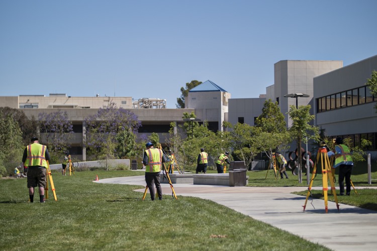
Land surveying is the process of measuring and mapping land, including its boundaries, topography, physical features, and human-made structures. Key outputs include boundary lines, contour maps, topographic details, location of utilities, and elevation points. Surveyors use tools such as total stations, GPS, drones, laser scanning, and GIS (Geographic Information Systems) to gather accurate spatial data.
Why Architecture Design Relies on Surveying
Architecture design is more than aesthetics; it must respond to real-world conditions. Surveying provides the data that allows architects and engineers to:
- Understand the Site’s Constraints and Opportunities
- Topography determines where buildings can be placed, the slope for drainage, view corridors, and orientation relative to sun and wind.
- Soil conditions (if included in geotechnical surveys) affect foundation choices.
- Existing vegetation, trees, water bodies, and utilities inform decisions about preserving elements or modifying site design.
- Ensure Legal Compliance and Boundary Accuracy
- Correct boundary lines are essential; encroachments can lead to disputes or legal issues.
- Local zoning, setback regulations, easements, and rights-of-way must be observed; survey data confirms what can legitimately be built and where.
- Inform Site Planning & Layout
- Architects can plan building footprints, circulation (roads, walkways), landscaping, parking, service access, and utilities more precisely when accurate measurements are available.
- Level changes or slope management are factored into design, reducing cost of earthworks and grading later on.
- Control Costs and Avoid Rework
- Mistakes in site data lead to costly change orders, delays, or redesigns.
- Early detection of expensive obstacles (e.g. underground utilities) or unexpected site conditions saves both time and budget.
- Enhance Safety and Durability
- Flood levels, soil erosion, slope stability—surveying helps in assessing risk.
- With precise information, design can incorporate safety measures and resilient features to withstand environmental stresses.
The Path from Survey to Design: How They Integrate
Below is a typical workflow showing how land surveying and architecture design feed into each other in a successful project:
| Stage | Surveying Output | How the Architecture Design Uses It |
| Preliminary Survey | Boundary map, site topography, existing structures & utilities | Determines building location, orientation, massing; analyses site constraints like slope or orientation to daylight |
| Detailed / Topographic Survey | Contour lines, elevations, slope, soil conditions, precise location of features | Guides site grading, drainage design, foundation levels, retaining walls |
| As-Built Survey | After site modifications / during construction, showing changes or deviations | Ensures designs are being followed correctly; allows adjustments to architectural details accordingly |
| Utility & Infrastructure Survey | Location of water, sewer, electrical, telecommunications, gas lines | Integrates service access into architectural design; avoids conflicts; ensures safety codes compliance |
Gemcon Engineering’s Approach: Survey + Design Synergy
At Gemcon Engineering, we believe that architecture design without precise surveying is like building on shaky ground—literally and metaphorically. Here’s how we integrate surveying into our architectural service process:
- Early Collaboration: Surveyors and architects work together from the project’s inception. When land is being considered, Gemcon’s survey team collects data that informs massing, orientation, and site zoning decisions.
- Advanced Technologies: We employ drone mapping, GIS, laser scanning, and GPS surveying tools to capture site data with high precision. This reduces human error and improves the richness of data for architects.
- Iterative Feedback Loops: As architectural design evolves, any changes that affect site conditions are fed back to surveyors. For example, if the building footprint moves or elevations are adjusted, we update the survey models accordingly to avoid discrepancies at construction.
- Sustainable & Contextual Design: Using survey data, Gemcon ensures designs respond to environmental contexts—slope, drainage, sun exposure, wind patterns, and existing ecologies. This helps in minimizing excavation, optimizing energy use, preserving natural features.
- Legal & Regulatory Conformity: Surveying ensures that the design complies with regulations—setbacks, zoning, height limits, easements. Gemcon’s services include verifying permissions and conforming to local municipal codes based on survey-verified boundaries and site specifics.
Case Impacts: What Survey-informed Design Achieves
When surveying and design collaborate well, the outcomes are tangible and valuable:
- Reduced Risk: Fewer surprises during construction—unexpected underground utilities uncovered earlier, correct elevation grading so drainage works as intended, minimal change orders.
- Enhanced Performance: Buildings sited properly with respect to sun, wind, and topography tend to be more energy efficient, comfortable, and resilient.
- Cost Savings: Less wasted material, less rework, more accurate bids, and better estimation of earthwork and utility works.
- Higher Client Satisfaction: Deliverables meet expectations, timelines are respected, the built form aligns with what was designed.
Practical Advice for Project Owners & Architects
If you’re planning a project—residential, commercial, or institutional—here are some tips to ensure land surveying and architecture design work harmoniously:
- Commission a Full Topographic & Boundary Survey Early: Before design sketches begin, get survey data so architects have a complete picture.
- Check for Legal Constraints Using Survey Data: Zoning limits, easements, flood zones—all can be identified via surveying.
- Keep the Survey Updated: If site conditions change (e.g., trees removed, site graded), update the data to avoid surprises.
- Use 3D Models & GIS Where Possible: Visualizing in three dimensions helps understand slope, shadows, views, and spatial relationships.
- Engage with a Firm That Offers Both Surveying & Design: Firms like Gemcon Engineering that provide both ensure fewer mismatches between what is surveyed and what is designed.
Conclusion
The connection between land surveying and architecture design is fundamental. Surveying provides the factual basis—site boundaries, topography, utilities, environmental context—that architects need to create designs that are functional, compliant, cost-efficient, and sustainable. When these two disciplines are integrated from the very start, projects run more smoothly, risk is reduced, and the overall quality of built environments improves.
For anyone planning a building or development project, choosing a partner who understands both surveying and design is essential. That’s where Gemcon Engineering stands out. With deep expertise in both land surveying and architecture design, they ensure every project is grounded in reality, built with precision, and elevated with creativity.